Clouds, those ever-changing spectacles in the sky, are more than just fluffy white masses. They are indicators of weather patterns, atmospheric conditions, and even artistic inspirations.
But how many of us can actually distinguish one cloud type from another? Let’s delve into the fascinating world of clouds and unravel their secrets.
How Clouds Are Classified

Clouds are primarily classified based on their altitude and appearance.
There are three main altitude categories:
High-level clouds
High-level clouds, residing above 20,000 feet, are composed primarily of ice crystals due to the frigid temperatures at these altitudes.
These clouds are distinguished by their thin, wispy appearance and often exhibit a brilliant array of colors when illuminated by the low sun angle during sunrise or sunset. The three primary types of high clouds are cirrus, characterized by delicate, hair-like strands; cirrostratus, forming a thin, veil-like sheet across the sky; and cirrocumulus, appearing as small, white patches or ripples resembling fish scales. While high clouds rarely produce precipitation, their presence can sometimes indicate approaching weather changes.
Mid-level clouds
Mid-level clouds, residing between 6,500 and 20,000 feet, are composed primarily of water droplets, though ice crystals can be present in colder conditions.
These clouds are characterized by their gray or bluish-gray appearance and often produce a uniform, layered effect. Altocumulus and altostratus are the primary mid-level cloud types. Altocumulus clouds form in patches or layers and can resemble small white or gray puffs. Altostratus clouds, on the other hand, create a thicker, more uniform layer that typically covers the entire sky, often obscuring the sun or moon. While altocumulus clouds can sometimes indicate fair weather, altostratus clouds usually precede precipitation, signaling an approaching storm system.
Low-level clouds
Low-level clouds are atmospheric formations that reside in the lowest portion of the atmosphere, generally extending from ground level to approximately 6,500 feet.
These clouds are primarily composed of water droplets, though ice crystals can also be present in colder conditions. Characterized by their flat, gray appearance, low-level clouds often bring drizzle or light precipitation. Common types include stratus, which forms a uniform, featureless layer; cumulus, appearing as puffy, white masses; and stratocumulus, a combination of both with a more patchy distribution. While often associated with overcast skies and mild temperatures, low-level clouds also play a crucial role in Earth’s climate system by reflecting solar radiation and influencing temperature and precipitation patterns.
Additionally, clouds are categorized by their appearance:
Cirrus

Cirrus clouds are ethereal masterpieces painted high in the sky. Composed entirely of ice crystals, they appear as delicate, wispy strands or feathery tufts. Born from the ascent of dry air, these clouds reside at altitudes of over 20,000 feet, their formation a result of water vapor transforming directly into ice. Often referred to as “mare’s tails” due to their elongated shape, cirrus clouds typically herald fair weather. However, their thickening and spreading can signal the approach of a warm front, ushering in potential precipitation. These clouds, while seemingly fragile, play a role in Earth’s climate, influencing both temperature and precipitation patterns.
Cirrocumulus

Cirrocumulus clouds are high-altitude wonders, appearing as delicate sheets or patches of tiny, white cloudlets in the sky.
Composed primarily of ice crystals, these clouds often arrange themselves in regular patterns, resembling ripples or fish scales, earning them the nickname “mackerel sky.” Though thin and seemingly fragile, cirrocumulus clouds signify convection in the upper atmosphere, a testament to the dynamic nature of our skies. Their presence typically indicates fair but cold weather, making them a captivating sight for cloud enthusiasts and weather watchers alike.
Cirrostratus

Cirrostratus clouds are high-altitude, thin veils of ice crystals that spread across vast areas of the sky. Often appearing as a milky sheen or a delicate fibrous sheet, they are so transparent that the sun or moon can be clearly seen through them. A distinctive characteristic of cirrostratus is their ability to produce halos, colorful rings or arcs surrounding the sun or moon, caused by the refraction of light through the ice crystals. While their presence often indicates the approach of a warm front and potential precipitation, they themselves rarely produce rain or snow. Cirrostratus clouds are typically found above 18,000 feet and can span hundreds of miles, creating a serene and ethereal backdrop to the sky.
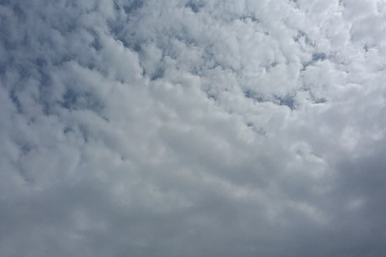
Altocumulus

Altocumulus clouds are mid-level atmospheric formations, typically composed of water droplets and sometimes ice crystals. Resembling a patchwork quilt of globular masses or rolls, they occupy a position between the higher cirrocumulus and lower stratocumulus clouds. Altocumulus often forms in layers or patches, with individual elements larger and darker than those of cirrocumulus. While they generally signify stable weather conditions, their appearance can vary widely, from the flat stratiformis to the towering castellanus. These clouds are known for their ability to produce virga, rain that evaporates before reaching the ground, and can sometimes be precursors to more severe weather systems.
Altostratus

Altostratus clouds are expansive, mid-level sheets of gray or bluish-gray hue, often blanketing the entire sky.
Composed of a mixture of water droplets and ice crystals, they are typically featureless and allow the sun or moon to shine through dimly, creating a diffused, watery appearance. Forming at altitudes between 2,000 to 8,000 meters, these clouds are harbingers of changing weather, often preceding the arrival of a warm front. As they thicken, they can transform into nimbostratus clouds, bringing continuous rain or snow. While altostratus clouds themselves may not produce precipitation reaching the ground, they are a significant indicator of approaching precipitation and a shift in atmospheric conditions.
Nimbostratus

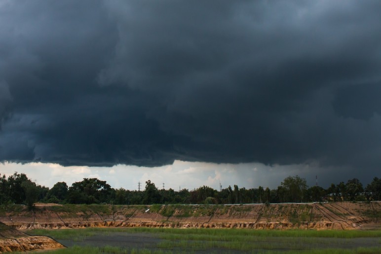
Nimbostratus clouds are somber, featureless blankets blanketing the sky, their dark gray hue blocking out the sun.
These low-lying clouds are the architects of persistent rain or snow, often associated with the slow, steady progression of warm or occluded fronts. Unlike their dramatic cumulonimbus counterparts, nimbostratus clouds bring a prolonged, dreary drizzle rather than intense downpours. Their uniform appearance offers little visual interest, making them perhaps the least picturesque of all cloud types. While they may dampen spirits, nimbostratus clouds play a vital role in the Earth’s water cycle, replenishing the land and ensuring the continuity of life.
Cumulus

Cumulus clouds, often likened to fluffy cotton balls, are emblematic of fair weather. These low-altitude clouds form through a process of convection, where warm, moist air rises, cools, and condenses into water droplets. Characterized by their flat bases and towering, white cumulus tops, they can appear solitary, in lines, or clustered together. While typically harmless, cumulus clouds can evolve into towering cumulonimbus clouds, capable of producing rain, hail, and even thunderstorms. Their appearance in the sky is a captivating spectacle, a testament to the dynamic nature of our atmosphere.
Cumulonimbus

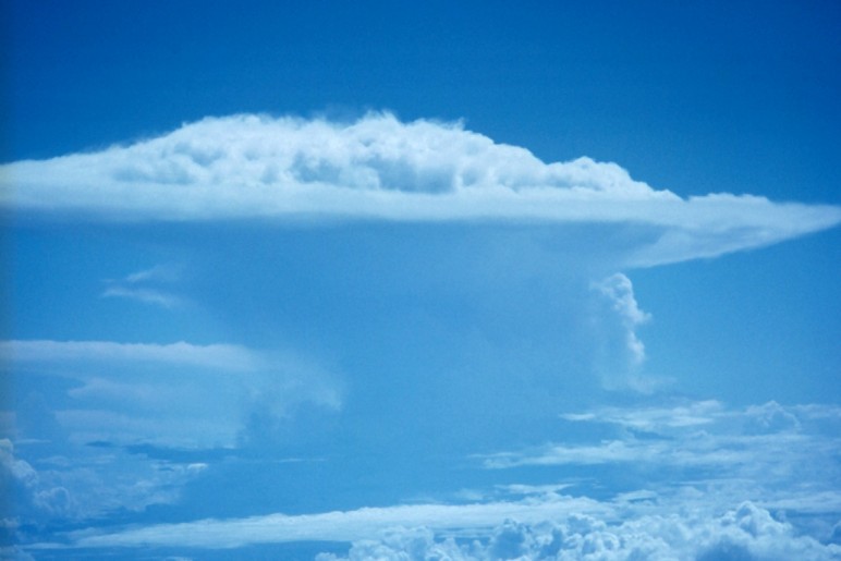
Cumulonimbus clouds are towering, ominous giants of the sky, capable of producing the most dramatic and dangerous weather phenomena.
These vertical behemoths form from powerful updrafts of warm, moist air, reaching incredible heights and often spreading out in an anvil shape at their summit. Dark and imposing, cumulonimbus clouds are synonymous with thunderstorms, unleashing torrents of rain, hail, and the electrifying spectacle of lightning. Beneath their menacing base, swirling vortices can spawn tornadoes, while strong gusts and downpours pose significant hazards. While their appearance is awe-inspiring, cumulonimbus clouds command respect and caution due to their potential for destructive force.
Stratocumulus

Stratocumulus clouds are low-lying, gray masses often appearing in clumps or rolls across the sky. Their bases are relatively flat, contrasting with the rounded, puffy tops. While they can sometimes merge to form a continuous layer, they more commonly exhibit gaps, allowing glimpses of the sky between them. These clouds are formed through weak convective currents trapped beneath a stable layer of air, preventing significant vertical growth. Though they can produce light drizzle or snow, they are primarily associated with overcast conditions and mild temperatures. Stratocumulus clouds are a common sight in many parts of the world, particularly in coastal regions and during stable atmospheric conditions.
Stratus

Stratus clouds are low-lying, featureless blankets of gray or white that stretch across the sky. Unlike their towering cumulus counterparts, stratus clouds form in stable atmospheric conditions, often producing a dreary, overcast day. These clouds are composed of tiny water droplets and can sometimes descend to the ground as fog. While they rarely bring heavy precipitation, stratus clouds can lead to persistent drizzle or light snow. Their uniform appearance and low altitude create a muted, subdued atmosphere, often associated with calm and tranquil weather.
Clouds Beyond the Basics
While these are the ten basic cloud types, there are numerous other fascinating cloud formations. Lenticular clouds, for instance, resemble UFOs and form over mountains.
Mammatus clouds have unique pouch-like structures on their underside. And then there are the elusive noctilucent clouds, found in the mesosphere and visible only at twilight.
Read More:
- Motion of the Ocean: Introduction to Wave Energy
- Managing Your Green Lifestyle: Practical Tips for a Sustainable You
- 5 Ways to Give Your Old Smartphone a New Life: Responsible Recycling Options
Featured Image Source: https://tinyurl.com/s9p7c7d8

